Hook Heath Residents' Association
Aerial views of Hook Heath
Click an arrow to see views of Hook Heath
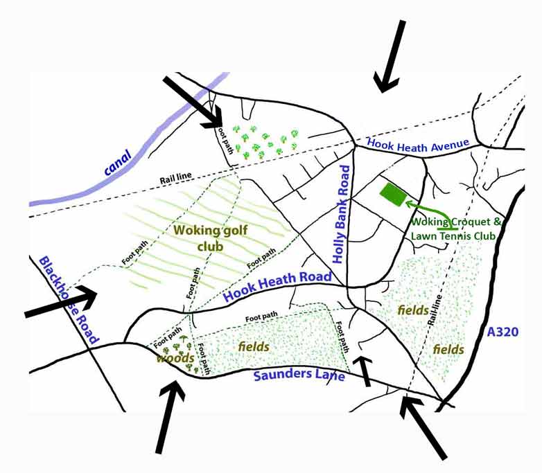
These aerial views of Hook Heath, taken from every possible angle, show the abundance of trees in this peaceful neighbourhood. These aerial views taken from a helicopter were prompted by the needs of the proposed Neighbourhood Forum to characterise the area. The leafy tree covered nature of the area is well captured in these helicopter views.
Click for the Privacy Policy for this website
Click if you wish to update cookies preferences for this website
-----------
The webmaster can be contacted on the following email address. Please retype it, as the electronic link has been removed to reduce spam.
webmaster@hhra.co.uk